![]() GPS and Satellite navigation provides a vital tool for regional fieldwork. GPS can be used both to map locations in the field, such as old roadways, newly located archaeological sites, or vegetation zones. These can then be entered into your GIS as point, line, or polygon data.
GPS and Satellite navigation provides a vital tool for regional fieldwork. GPS can be used both to map locations in the field, such as old roadways, newly located archaeological sites, or vegetation zones. These can then be entered into your GIS as point, line, or polygon data.
GPS can also be used on the other end of analysis, in that after analysis is completed, for example, for an environmental or archaeological predictive model, or to locate a feature identified on aerial imagery, you can download that location into your hand-held GPS and then use it to guide you to that specific location in the field.
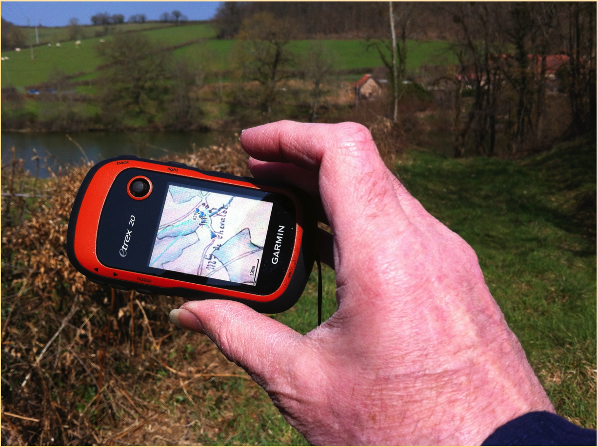
A very exciting and new application is the ability to download historical maps (as shown in the graphic above) or GIS or imagery data into your hand-held GPS and you can navigate in real time in the field while looking at where you are on the historic map. We have used this capability in our Burgundy research and it has been very useful. We have identified old roadways and even individual historical structures that are no longer standing using this method.
Click on the image and you will see, on the small GPS color screen, our 1834 detailed map showing where I am standing (the blue arrow at center). It shows an old roadway, that is visible not he right side of the image, and an old mill site and pond just beyond.