![]() One of the great improvements in our ability to locate, document, and study our cultural resources is the development and maturation of Open Source Geomatics tools. Researchers around the world can now conduct extensive work in GIS, GPS, remote sensing, aerial photogrammetry, drone imagery, and historical cartographic analysis, all using Free and Open Source Software (FOSS) on their own laptops.
One of the great improvements in our ability to locate, document, and study our cultural resources is the development and maturation of Open Source Geomatics tools. Researchers around the world can now conduct extensive work in GIS, GPS, remote sensing, aerial photogrammetry, drone imagery, and historical cartographic analysis, all using Free and Open Source Software (FOSS) on their own laptops.
And they can do this in over 20 different languages, and the high cost of commercial GIS software and English language ability are no longer barriers to access these important tools. I now rely on the QGIS tools (www.qgis.org), which serves as a platform for doing all of these using a very simple and easy-to-use interface. QGIS also allows integrated access to other tools such as GRASS GIS, SEGA, Orfeo, relational databases, GNSS tools, and much more. And it runs on Mac, Windows, and several versions of Linux.
There is a large and growing community of QGIS users involved in archaeology and historical and regional analysis, and several dedicated conferences like the CAA, Computer Applications and Quantitative Methods in Archaeology annual conference.
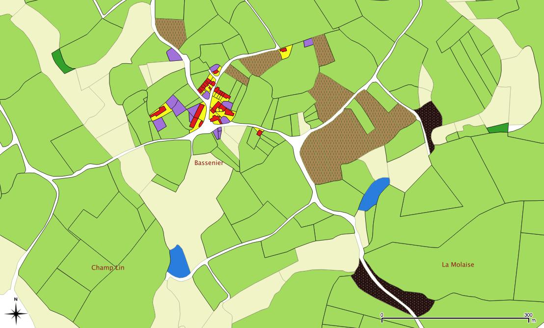
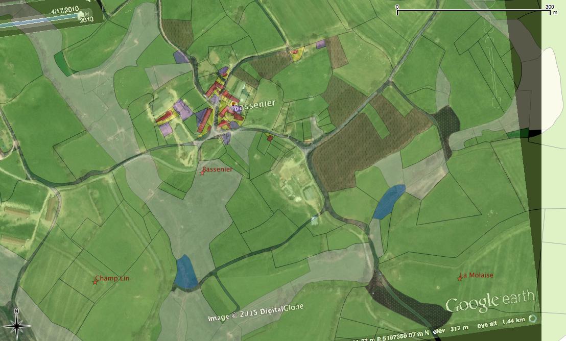
Two QGIS images of our 1834 cadastral GIS data,. Structures are red, ponds are blue, fields are light green, forests are dark green. Property ownership boundaries are in black. The GIS data are overlaid on satellite imagery at right.