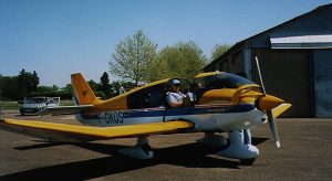
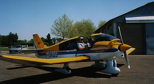
 Aerial photography, both historical and modern, provides vital information about the landscape, but they are static. Aerial archaeology has a long history in archaeology, and we have used a wide variety of tools in our work. I have flown my own light aircraft for many years, searching for evidence of archaeological sites, roads, and other features in France. Aerial archaeology has a long and interesting history in Europe, and thousands of archaeological sites have been discovered using light aircraft, hand-held cameras, and , more recently, GPS receivers.
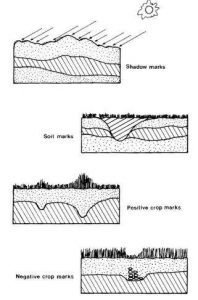 Aerial archaeology uses a variety of very subtle variations on the ground to be able to see patterns which indicate the presence of buried archaeological features, including structures, roads, earthworks, and other features. The graphic below shows four four of the most common ground features. These include shadow marks, soil marks, and positive and negative crop marks. Shadow marks show the subtle changes in terrain that can show sunken roadways or ridges. Snow marks can show similar features just after a snow. Soil marks show the color changes in filled in areas or such. Crop marks show differences in modern vegetation that is affected by buried features. Positive crop marks show more vegetation or crop growth, often evidence of ancient post holes or gardens. Negative Crop marks show the opposite, where there is less vegetation, often due to buried walls or structures. These features are often visible from the air while being quite indistinct on the ground.

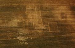 The color image here shows an aerial photo that I took in the summer of 1979, and it shows the outline of a buried Gallo-Roman villa which we discovered. The outline of the walls are clearly visible, but are very hard to see on the ground. On the right is a square positive crop mark that could have been a stable, animal pen, or garden.
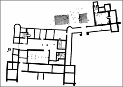 Here is a graphic of a similar villa located in Germany.